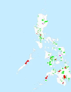
General Santos
Southernmost highly urbanized city in the Philippines.

General Santos, officially the City of General Santos and abbreviated as GenSan, is a highly urbanized city in the Soccsksargen region of the Philippines. It has a population of 722,059 people according to the 2024 census, making it the most populous city in Soccsksargen Region. Located on the island of Mindanao, it is the southernmost and 13th-most populous city in the Philippines. It is the regional center for commerce and industry in the Soccsksargen region. It is the largest and the only coastal city in the province of South Cotabato, wherein it is geographically situated and grouped under the province by the Philippine Statistics Authority but administered independently of it.
- Population (2024 census)
- 722,059
- Region
- Soccsksargen, Philippines
- Island
- Mindanao
- Classification
- Highly urbanized city
- Named after
- General Paulino Santos
- Original inhabitants
- Blaan people
- Cityhood established
- July 8, 1968
Verified Timeline
Lore & Background
The city was named after General Paulino Santos, a commanding general of the Philippine Army and the settlement's leading pioneer. The nomadic Blaan people are the original inhabitants of present-day General Santos, and their name for the city, Dadiangas, is from the Ziziphus spina-christi tree that was once abundant in the area and is now a protected species under Republic Act 8371. General Santos was severely affected by the 2026 Mindanao earthquake. On June 8, 2026, a Mw 7.8 earthquake struck off the southern coast of Mindanao, resulting in fatalities and a state-of-emergency in General Santos.
Reader's Guide
General Santos holds significance as the economic and industrial hub of the Soccsksargen region, driven by agri-based and multinational firms such as Dole Philippines and General Milling Corporation, which expanded there in the 1960s. Its history reflects the complex interplay of indigenous Blaan culture, Muslim sultanates, Spanish colonization, American governance, and large-scale Christian settlement under the Commonwealth. The city's resilience was tested by the 2026 earthquake, which caused widespread damage. Its legacy includes the preservation of Blaan place names and the protected Ziziphus spina-christi tree, alongside modern educational institutions like Notre Dame of Dadiangas University and Mindanao State University–General Santos City.
Did You Know?
- The city's original Blaan name, Dadiangas, comes from the Ziziphus spina-christi tree, now a protected species under Republic Act 8371.
- On February 27, 1939, General Paulino Santos led 62 Christian settlers from Luzon aboard the steamship Basilan to establish the first large settlement.
- General Santos was severely affected by a Mw 7.8 earthquake on June 8, 2026, which caused fatalities and a state of emergency.
- The city has an average annual rainfall of less than 1,000 millimeters, making it one of the driest places in the Philippines.
- General Santos became a highly urbanized city independent from South Cotabato on September 5, 1988.
Indigenous Roots & the Pioneer Generation
The land that would become General Santos was first home to the nomadic Blaan people, whose vocabulary still echoes in local place names. Their name for the area, Dadiangas, derives from the Ziziphus spina-christi tree that once blanketed the landscape and is now a protected species under the Indigenous Peoples Right Act of 2007. Over time, the arrival of Muslim settlers under the Sultanate of Maguindanao pushed the Blaan upland into the surrounding hills, a displacement that would deepen in the decades to come. The modern settlement story begins on February 27, 1939, when General Paulino Santos, a commanding officer of the Philippine Army, led sixty-two Christian settlers from Luzon across Sarangani Bay aboard the steamship Basilan of the Compañía Marítima. Organized under the National Land Settlement Administration of President Quezon's Commonwealth government, these pioneers—mostly graduates in agriculture and trade—landed with a mandate to cultivate the region industriously. Their arrival triggered a wave of further migration from Visayas and Luzon, gradually reshaping the demographic fabric and pushing remaining Blaan communities further into the highlands.
Colonial Seeds & the Birth of a Townsite
The earliest recorded European presence in the area dates to 1898, when two brothers from Barcelona, Jose and Alberto Olarte, took up residence in Makar, a locality now known as Brgy. Labangal. Under the American Insular Government, the Municipality of Makar was formally established on October 29, 1903, and a decade and a half later, on July 23, 1914, the Municipal District of Buayan was created to the east. Together, these two settlements would form the western and eastern halves of what is now General Santos. The decisive planning moment came in 1924, when the Provincial Board of Cotabato proposed a 300-hectare market settlement intended to channel agricultural produce flowing from Allah Valley and the lands south of Lake Buluan. Makar was included within the proposed zone, which was subdivided into three areas. The proposal reached Governor-General Henry L. Stimson in 1928, yet for reasons that remain unexplained, only a single section received approval. That section—a flat plain scattered with evergreen trees—carried the name Dadiangas and would go on to serve as the nucleus around which the entire city grew.
War, Reorganization & the Name That Stuck
During the Second World War, the Municipal District of Buayan sat on one of the final front lines separating combined American and Filipino forces from the Empire of Japan. Retreating Imperial troops chose Klaja Karsts Land as their last defensive ground, digging round cement bunkers and tunnel networks into the terrain. The bunkers remain visible at Sitio Guadalupe to this day, though most of the tunnels have been damaged or destroyed by treasure hunters and land developers over the decades. In the post-war reorganization, President Manuel Roxas issued Executive Order 82 on August 18, 1947, elevating Buayan to a fourth-class regular municipality and absorbing both Makar and the Municipal District of Glan. Dadiangas became the seat of government, and Irineo Santiago was elected its first municipal mayor in November 1947. Six years later, in June 1954, Act No. 1107—authored by Congressman Luminog Mangelen of Cotabato—officially renamed the municipality General Santos in tribute to the pioneering general. The name endured even when, in the 1960s, residents rejected a proposal by Congressman Salipada Pendatun to rebrand the town as Rajah Buayan.
Economic Boom & the City Today
Between 1963 and 1967, General Santos experienced a rapid economic surge under Mayor Lucio A. Velayo as major agri-based and multinational corporations—including Dole Philippines, General Milling Corporation, and UDAGRI—expanded their operations into the area. The municipality's growth was so pronounced that it qualified for fourth-class city status, yet the path to formal elevation was not immediate. On July 8, 1968, the Municipality of General Santos was finally converted into a city upon the approval of Republic Act No. 5412, authored by Congressman James L. Chiongbian. Today, General Santos—commonly shortened to GenSan—stands as a highly urbanized city and the most populous in the Soccsksargen region, with a 2024 census population of 722,059. It is the southernmost and thirteenth-most populous city in the Philippines and serves as the regional hub for commerce and industry. Geographically situated within the province of South Cotabato, it is the largest and only coastal city in that province, grouped under it by the Philippine Statistics Authority while being administered independently. The city's trajectory was tested in 2026, when it was severely affected by the Mindanao earthquake, a reminder that even a thriving urban center remains vulnerable to the forces of the island it calls home.
Frequently Asked Questions
Who is General Santos?
General Santos, commonly called GenSan, is a highly urbanized city on the island of Mindanao that anchors the Soccsksargen region. It is home to roughly 722,000 people per the 2024 census and holds the title of the region's most populous city.
What role does General Santos play in its region?
It functions as the commercial and industrial engine for all of Soccsksargen, drawing trade and manufacturing activity from surrounding areas. Because it is classified as highly urbanized, it governs itself independently rather than falling under South Cotabato's provincial authority.
Where is General Santos and what makes its location stand out?
Perched on Mindanao, it is the southernmost highly urbanized city in the entire Philippines. It also ranks as the 13th-most populous city nationwide, making it a major urban node in the country's far south.
Who is General Santos named after?
The city honors General Paulino Santos, a historical military figure. Before the city's founding, the land was home to the Blaan people, the area's original inhabitants.
Why is General Santos important to the broader Philippines?
As the southernmost highly urbanized city, it marks the geographic limit of the country's top-tier urban centers. Its independent status and role as the sole coastal city in South Cotabato give it a unique administrative and economic position in Mindanao.
More in Philippine Cities 1-18
Spotted an error? Know more?
This is a living reference — every entry is fact-audited, and reader corrections feed straight into our audit queue. Suggest an edit · See this site's audit record